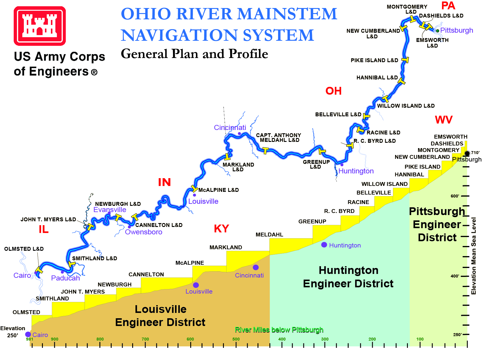
The Ohio River Basin comprises a large geographic area of the United States east of the Mississippi River: 204,000 square miles, which is home to nearly 25 million people. It reaches northeast into New York, west to Illinois, and south through the drainage area of the Tennessee River in Georgia, Alabama, and Mississippi. Through the heart of this vast area, the 981 mile-long Ohio River carries the largest volume of water of any of the Mississippi River tributaries. The Ohio is formed by the juncture of the Allegheny and Monongahela rivers at Pittsburgh, Pennsylvania, and empties into the Mississippi at Cairo, Illinois.
The Ohio River and its seven navigable tributaries comprise over 2,500 miles of waterways, and moves more than 270 million tons of coal, aggregates, chemicals, agricultural, industrial and petroleum products. This waterway transportation provides a less costly means for companies to transport bulk goods, moving 35% of the nation's waterborne commerce. The Ohio River is home to 49 coal-fired power plants, 20 percent of nation’s coal-fired electricity generation capacity.
The river provides more than half a million jobs and generates billions of dollars in business activity. The Corps of Engineers maintains a 9-foot channel depth on the Ohio River navigation system. These pools also serve as a source of quality drinking water for millions of people who reside in the Ohio River valley.
The Ohio River navigation projects are built, operated and maintained by the U.S. Army Corps of Engineers to serve the regional transportation needs with continuous year-around, 24-hour-a-day operations. Since 1910, when the Rivers and Harbors Act authorized the Corps of Engineers to complete a system of locks and dams for navigation, modernization of the system has continued to meet the transportation demands of the region.
