2825 Overlook Rd
Taylorsville, KY 40071
(502) 477-8882
Office hours: M-F, 7:30 a.m. - 3:45 p.m. (may vary, call ahead)
Lake Levels
Lake temperatures/dissolved oxygen profiles are taken weekly during lake stratification which typically occurs from late spring through early winter.
Please visit our Facebook page by clicking here.
Location
Taylorsville Lake is located on the Salt River beginning at river mile 78 about 5 miles west of Glensboro and extends downstream to the dam at river mile 60. The Lake is 18 miles long and extends into portions of Spencer, Nelson and Anderson Counties of Kentucky. The dam is located about 20 miles from Exit 23 on the Gene Snyder in Louisville and about 50 miles from southwest Lexington.
Authorization
Taylorsville Lake was authorized under the Flood Control Act of 1966. The Louisville District of the U.S. Army Corps of Engineers designated, built, and now operates the project for flood control, quality water storage, outdoor recreation, and fish and wildlife preservation and enhancement.
History
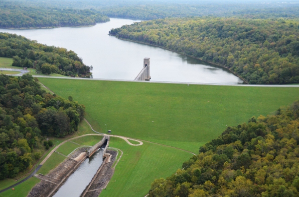
The lake bears the name of nearby Taylorsville, founded in 1799 by Richard Taylor, landowner and proprietor of a local gristmill. The town occupies 60 acres of land donated by Taylor at the mouth of Brashears Creek. The Salt River was named for the numerous salt works that operated along its banks during the 1800s. Flooding occurred along the Salt River for decades, destroying crops, wrecking communities and threatening lives, which drove citizens to ask their elected representatives for help. Construction on the dam began in 1974 and was completed in 1983. The dam is over 4 football fields in length and 15 stories high. It is an earth and rock fill structure designed to hold an additional 45 feet of water over seasonal pool as flood storage. In addition to the primary purpose of flood control, the Taylorsville Lake project offers 3050 acres of water which provide outdoor recreation opportunities, fish and wildlife enhancement, and quality water storage.