Congress Authorizes Flood Risk Management Study for Southeast Michigan
This study is authorized in the 2022 Water Resources Development Act (WRDA) which allows the U.S. Army Corps of Engineers (USACE) to work on flood risk management in Southeast Michigan.
In WRDA 2022, Congress expanded USACE’s authority to study comprehensive flood risk management. This authority may help communities better manage flood risk in urban areas.
Non-Federal Sponsor
Following legislation passed in 1986, congress required USACE to partner with a non-Federal sponsor to develop feasibility studies. This legislation identified cost-sharing provisions as well as key roles and responsibilities for sponsors to play in project planning and design. The sponsor must contribute 50% of the study costs that exceed $100,000, and the sponsor plays a key role in defining the water resources problems, objectives, and study scope.
The non-Federal sponsor for this study is the Great Lakes Water Authority (GLWA). GLWA is the regional wastewater utility for southeast Michigan, providing wastewater services for nearly 30% of Michigan. GLWA has requested USACE to study comprehensive flood risk in southeast Michigan, to address flooding issues including:
- Flooding caused by heavy rainfall
- Fluctuating water levels in the Great Lakes and connecting waterways
- Impacts from climate change
About the Study
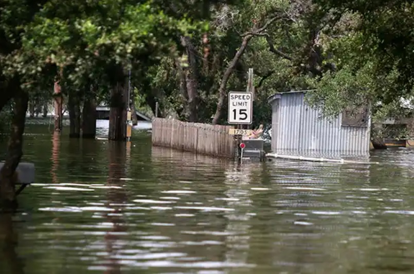
 Southeast Michigan has experienced repeated, widespread flooding for decades and has received five federal disaster declarations due to flooding since 2000. Flooding in the region has resulted from more intense and frequent rainfall, storms, and fluctuating Great Lakes and connecting corridor water levels. This flooding causes damage to structures and infrastructure, impacts the local, regional, and national economy, and creates social hardship for Michiganders. The transportation system includes numerous below-grade highways, which require pumps to clear streets during rain events. During large storms, these highways can be closed for days at a time. Basement backups are increasingly common in portions of the region during large storms, where local or downstream surcharging leads to recurring household flooding.
According to the Federal Emergency Management Agency (FEMA), there have been more than 260,000 flooding-related Individual Assistance claims in the study area since 2004. 97% of the claims in Detroit occur outside FEMA’s Special Flood Hazard Area, highlighting a significant urban flooding issue in the region. FEMA has also reported more than 40,000 high flood-risk properties in the study area since 1978.
 These high flood-risk properties have experienced either:
- Individual Assistance (IA) Repetitive Loss, where a structure has had at least two IA FEMA inspections showing some level of flood water in the structure, including basements/crawlspaces, or
- IA Severe Repetitive Loss, where a structure has had at least four IA FEMA inspections showing some level of flood water in the structure, including basements/crawlspaces, or
- National Flood Insurance Program (NFIP) Repetitive Loss, where a FEMA NFIP-insured structure has had at least two paid flood losses of more than $1,000 each in any 10-year period since 1978, or
- NFIP Severe Repetitive Loss, where
- Four or more $5,000+ claim payments were made, or
- Two or more claim payments were made cumulatively exceeding the structure’s value (before flood damage).
Explore FEMA’s Historical Flood Risk and Costs tool to better understand historical flood impact in your county.
In August 2014, the region experienced record-breaking rainfall—more than six inches in four hours—resulting in a federal disaster declaration. Another federal disaster declaration was issued after more than six inches of rain fell within 24 hours on June 26, 2021. After the June 2021 floods, the Great Lakes Water Authority worked with congressional representatives to authorize the study under the WRDA 2022 legislation. In 2024, USACE received an initial $500,000 to begin the study.
Our Shared Vision
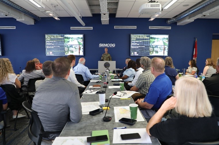
 To foster a shared vision for the Southeast Michigan Flood Risk Management Study, the USACE Detroit District and the Great Lakes Water Authority (GLWA) launched the study with a planning charrette that included local, regional, state, and federal government stakeholders in Detroit from Sept. 16-18, 2024. The group developed a preliminary shared vision, which will continue to evolve as more stakeholders are engaged.
Widespread flooding in Southeast Michigan has led to significant economic burdens and social hardships. Urban, riverine, and coastal flooding in the region has increased risks to public safety and health, caused property damage, disrupted critical infrastructure, and led to economic losses for residents, businesses, industries, and local and state governments. The Southeast Michigan Flood Risk Management Study will investigate options to reduce risks to human life and lessen economic, industrial, and commercial flood damage in the study area over the period of analysis. Opportunities exist to improve community and infrastructure resilience, water quality and associated public health outcomes, public awareness of flood risk management and preparedness, and the overall quality of life in Southeast Michigan.
Study Area
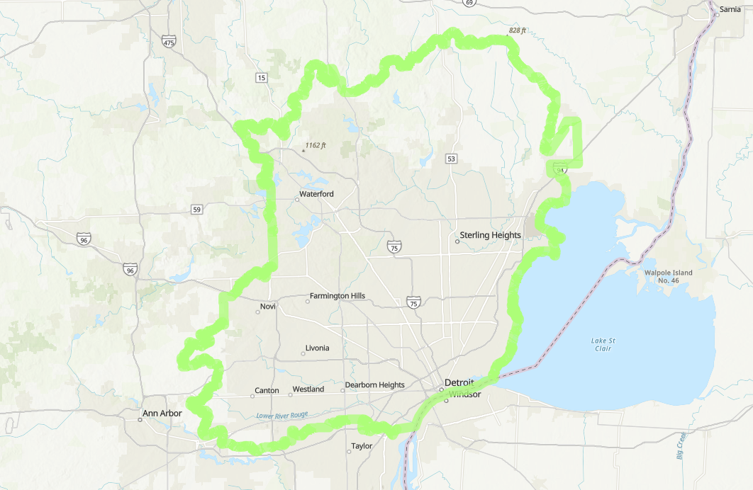
 The study area includes the Clinton River, Lake St. Clair, Rouge River, and Detroit River watersheds, as well as the Great Lakes Water Authority’s separated and combined sewer service area.
Use the interactive map below to engage with data in the study area
Scope, Schedule, and Budget
The key components of the study scope are investigating the pluvial (rainfall-driven) and fluvial (riverine/coastal-driven) flooding analysis, a full array of alternatives and comprehensive benefit considerations, NEPA compliance, and community outreach.
The study team is requesting an exception to the schedule and funding requirements established by Section 1001 of the Water Resources Development Act of 2014. The exception would allow for exceeding the three-year timeline and $3 million federal cost limit, given the scale and complexity of the project. Once a schedule and budget are approved by the Assistant Secretary for the Army of Civil Works, it will be posted. The bulk of the study time and funding will be allocated to the alternative evaluation and analysis phase. This phase will include developing 2D hydraulic and hydrologic modeling, creating various economic models, preliminary engineering and design of potential alternatives, and analyzing environmental, historical, and cultural resources as well as community considerations.